AI-powered geospatial analysis: satellite imagery, terrain modelling, change detection, route optimization, and spatial analytics at cloud scale.
50+ Capabilities
Multi-temporal satellite analysis for construction, deforestation, and urban change.
DEM generation, slope/aspect, viewshed, and hydrological modelling.
Building footprints, road networks, and infrastructure from imagery.
Supervised and unsupervised land use/land cover mapping.
Network analysis, shortest paths, and logistics optimization.
Clustering, hotspot analysis, and spatial statistics at scale.
Real Evidence
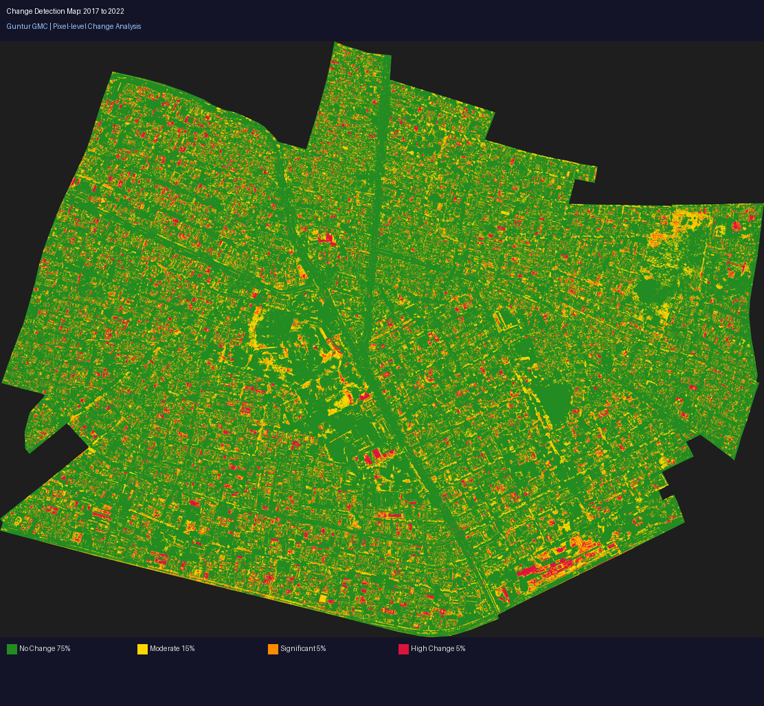
AI change detection: automatically identified land-use changes in Guntur between 2017 and 2022
How the entire Nebula ecosystem works together
The AI engineering interface β web, desktop, and workbench
11 domain-specific GPU-powered cloud environments
Interactive demonstrations across all capabilities
From intent to verified engineering artifact.